Underwriter Support
We provide comprehensive and customized solutions to support underwriters to get insights about the insured entity.
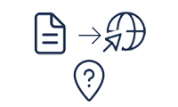
Geocoding & Reverse Geocoding
We provide various customized geocoding as well as reverse geocoding services using automated, semi-automated and manual methods based on the quality of the input, target accuracy requirements and commercial viability with respect to budgets. Our vast experience help the technical discussions with experts at client side to arrive at the most suitable process to follow.
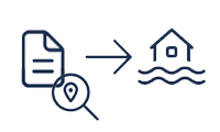
Risk Assessment
Risk Assessment often refers to assessment of risk using a set process agreed with the client for one or more portfolios. Generally the requirement will be for large set of records in single or multiple portfolios. We closely work with clients and our team well experienced in the domain performs the task as per the set procedures.
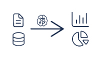
Data Insights
It is always important to get insights about the data to take decisions. The input data is always large in quantity and might not be of same format always. The differentiator for us is our expertise in generating data insights from spatial data unlike conventional tabular data. The spatial data comes either in vector map data or comes in raster datasets - the temporal rainfall foot prints over time steps for example. These insights play a key role in helping the underwriters to take key decisions.
Risk Management
Risk Management Solutions are solutions to generate simulated scenarios and to do to what-if analysis. It helps the insurance providers to understand the risk they are dealing with insuring properties against catastrophes. Another aspect of risk management solutions are to do assessments on expected losses for an occured event before the claims start coming.

Catastrophic Risk Modeling
There are several methods of CatRisk modeling based on deterministic methods as well as stochastic methods. But one thing is common. The accuracy of the output from any model is depended on the quality of the input data. Out team has vast experience in preparing the data for modeling purposed, porting the existing data to suit the model choses, doing the actual modeling or running a chosen commercial model (or a model custom developed by client) using data prepared by us or supplied to us. We have experience in full spectrum of activities in the CatRisk Modeling.
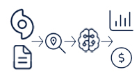
Event Responses & Loss Runs
Whenever an even occurs, every even is practically different even though they might follow a particular pattern for an area. The difference is that the losses will be different for each insuring entity because their portfolios will be different. Our experienced team help in performing loss runs (which generally combined with geocoding) for an event (occured event or predicted synthetic event) for a particular portfolio against different coverages using the chosen model.
GIS Services
A Geographic Information System (GIS) is a computer-based system used to capture, store, analyze, manage, and visualize geographic or spatial data. It integrates hardware, software, and data to process information linked to a specific location. One of the major advantages of our team is their expertise and experience in generating GIS ready data and performing Spatial Analysis.
Map Digitization
In modern terms, Map Digitization not necessarily mean drawing vector layers over a scanned and geo-registered map. It refers to generating spatial data from various sources through various techniques, which are suitable to the target purpose - mostly for spatial analysis. We have extensive experience in grabing, converting and digitizing data suitable for Spatial Analysis as well as for using in a GIS application like a WebGIS providing online analytics based on user specified parameters.
Spatial Analysis
One of the major tasks (or advantages) of using GIS is that it allows users to understand spatial relationships, patterns, and trends, enabling informed decision-making across various fields. Our team has extensive experience in handling spatial data (both vector as well as raster) and performing spatial analysis to bring required insights on spatial relationships. This is very crucial in decision making as well as helps as guidelines to the modeling team.
Format Conversion and Data Cleansing
One of the major issue with data - mostly procured from third parties is that the data might not be having the characterestics suitable for the target model we intend to use. Our experience helps us in quickly cleaning the data to eliminate issues, which might give wrong results in modeling as well as make them light weight without loosing its required accuracy levels to make the model runs faster. Many of the times data procured from multiple sources will have different formats and we will have to bring them to the data model we are using in the model development and use. We help our clients to achieve this quickly with out well set automated and semi-automated methods with manual over-rides wherever required.
Software Services
Rather doing everything in software based applicaton development, we have unique and distinct interst to focus only on applications and tools development pertaining to the domain we are specialized. That gives our clients unique offerings on what they are looking for! Our software services are ranging from creating WebGIS applications dealing 2d as well as 3d spatial data - both vector and raster, specialized essential tools development inside the full spectrum of life cycle of catastrophic risk modeling as well as data analytics for insurance industry.
Complex Web Scrapping
We have extensive experinece in scrapping data from dynamic and complex websites, which do not restrict from scrapping to build data. For example there are sites getting updated with data on movement of rainfall foot prints, earth quake events, rain gage measurements etc. Out specially developed scraping agents monotor the sites at intervals, crawl and scrap data as and when there are updates. Those are then downloaded and converted to required data formats suitable to the target analysis and/or processes.
RPA, AI and WebGIS
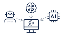
Modern WebGIS applications are often clubbed with presentation interfaces with customible 2d and 3d thematic maps from underlaying data. It also can be clubbed with on the fly dynamic creation of data using appropriate AI algorithms and on the fly generation of maps from the resultant data from AI. Our team is well versed with selection of appropriate supervised/unsupervised AI algorithms suitable for the purpose and incorporate them in the applications we make. We also well versed in use of commercial as well as open source RPA agents.
Digital Transformation
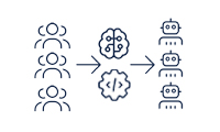
We also undertake consulting assignments to transform existing insurance processes to replace human agents with digital agents to automate the process to the extent feasible with human in the loop overrides, wherever required. This delivers values like bringing optimum efficiency in the process, reduces operating cost, reduce the TAT, ensuring consistent quality, reduce dependancy on human operators and bring best end customer experience.
Raster and Vector Data Processing Tools
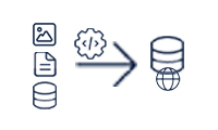
Inside a well set process, there always be a scope for continuos improvements through creating task specific tools. It can be as simple as a macro in MS-Excel to a complex procedure inside a spatial database like PostGIS powered Postgresql. We have expertise in creating task or process specific tools in multiple platforms popular in the industry.